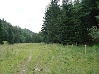
We started our hike in Leoben in July 2009. Leoben is a nice town in the eastern part of Austria about 70 km north of Graz. My friend Miha and I admired the very beautiful and old buildings in Leoben. We also met very friendly people there who helped us with advice on where we had to go to find the beginning of the trail. There were not many signs in the town. They started on the outskirts of the city.

On the first day we had to go to Mugel. Mugel is a mountain above Leoben and it is easy to see because it has a big telecommunications tower on top.

The trail to Mugel goes through a forest and it is pretty steep in some places, especially near the top of the mountain.

We first met cows and sheep around a hut called Schmollhube which was under Mugel.

We crossed an another mountain pasture with a house and cows. At the end we climbed up by a steep forest trail to the top of Mugel where there was hut named J. Hans Prosl Schutzhaus. We passed the night in this house. This night we got very useful information from a mountaineer who had done the same trail as we had to do the next day. He showed us on the map where we would be able to go because trees at this place don't allow passage on the normal trail. This information enabled us to get to Eibiswald on time.

The next day we had to walk the most dificult section of the trail on our hike. We had to cross a lot of mountain peaks such as Pöllasattel, Fensteralm, Polsterkogel, Eiblkogel, Lärchkogel, Speikkogel and some pastures with huts. A special place was the forestry house Hochalm which lay a slightly lower under the mountains.

We started a sharp ascent here to several mountains which we had to cross today. But first we went along a rivulet for some time before the trail finally started to ascend.

In this area there were fallen trees all around, and we found the way to the first mountain of this section named Fensteralm.

Then we had to go around several mountains: Polster kogel, Eibl kogel which were quite far apart. I remembered only that you had to go for a very long time up by mountain slopes. When we came to Lärch kogel we thought that we only had to descend to the valley to the mountain hut. But this was wrong. First we had to reach the Speikkogel - a long way away by Lärchkogel. We were very tired by that time and we needed another hour to walk to Speikkogel

After this we finally reached Speikkogel from where we alighted on Gleinalmhaus. We had dinner and slept in Gleinalmhaus. The innkeepers were Greek people, brother and sister, so we were able to eat some greek food. The first dish was more international, goulash, the second was greek, some kind of pie.

Next day we went toward Roßbachalm which was really a steep mountain and 1848 m high. But we didn't go on the top of this mountain, we crossed in the middle of its slope.

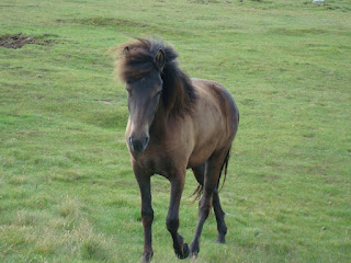
We walked for some hours across the pastures, mountain forests and slopes. On the trail we looked at the beautiful horses which wanted food from us.

Finally we came to a macadam road which took us to Oskar Schauer Sattelhaus. There was a waitress - a very friendly woman, born in Croatia. She explained and showed us where Gaberl was. I have to say that Gaberl is a very noticeable place from places all around because it has wind energy converters. We walked for some hours across the forest sometimes a bit up or down and came to the main road from Judesburg to Köflach. There we were able to see a lot of motorcyclists on the road and in the pub on the top of Gaberl.

We sat in this pub for 3/4 hour. After that we continued our way and passed the first of the wind energy converters.

Again we walked across the forest and up a bit and we came to a popular hut, named Altes Almhaus. There were some cars behind the pub which mostly came by the same road as us, though we sometimes went by the forest trail that shortened our way.

From Altes Almhaus we walked again by macadam road and forest trail until we came to the foothills of Rappoldkogel. We didn't know that we would climb to Rappoldkogel around 7 o'clock p.m. which was almost 2.000 meters high.

After 1,5 hours we arrived exhausted at the peak of Rappoldkogel. We were scared that we wouldn't get to Salzstiegelhaus until night. We saw this hut far away from the peak of Rappolkogel.

We were lucky to come along the very steep slope to Salzstiegelhaus before nightfall. Salzstiegelhaus had good food and rooms for us to sleep. There we met a group of students of geology who partied until the next morning.

The next day we went along a ski slope first. Here we met more wind energy converters. But we didn't go to the top of Speikkogel. We turned left toward a long mountain slope of Speikkogel.

We first walked down along a very bad trail - narrow and full of small stones. We went across a forest of small conifers being hit by branches. Finally we started to go up and we came to the better trail which took us up the slope until the trail started to go down.

There we noticed the special dark old stones. We needed about 30 minutes to get to Bernsteinhütte. There we ordered apple juice and water, put them in our rucksacks and after 30 minutes we went on toward Knödelhütte which was very near the first hut. This hut had a lot of visitors, brought here by car.

From Knödelhütte we travelled on a macadam road which brought us to another hut named Barbarahaus. We walked along forest trail for the final part. There we met a very friendly innkeeper who served us apple juice and water again. He also explained to us where the Fichtenhof/Gruber pub was - and what time we needed to get there.

We knew that we needed around 3 hours to get to the Gruber pub. First we came to the small village and after that the road from Styria to Carinthia. Soon we came through the forest near to the Graz - Vienna motorway.

Then we went along a macadam road and forest trail to the Gruber pub. We though that the road would be shorter but it took 2 hours to reach the asphalt road which goes to the Gruber pub. It was a nice place to eat, drink and sleep.

Next day we started at 5 a.m. We walked in direction of Wainebene. The trail went through forest the most of the time uphill and passing some huts like Gregor Peter Hütte, Stoffhütte.

When we came out of forest we were able to see Große Speikkogel in the distance. There we slept that day in Koralalpenschutzhaus.

We again walked a long time crossing the slope before we started to go down toward Albert Schimmer Haus.

After a short stay in this hut we started the slope to Große Speikkogel which was 2140 m high. At the beginning we walked along a macadam route, later we came on a steep mountain trail which took us to the top of Große Spaikkogel

There we met a lot of people who had the same purpose as we reached the top. There were a lot of cows and we also met a lone cyclist.

On the top of Große Speikkogel we were able to see the cross, some people and a radar installation.

We needed about 3/4 of an hour from Speikkogel to Koralpenhaus. We went first for a short time by asphalt road, then we walked down along a mountain trail with a lot of smaller or bigger stones. We came to a typical alpen hut which had some neccessities: food, drink, sleep and photo albums about the walks in the surroundings. We found there a note about a hiker who had walked from Nord cup to Kosovo. He walked about 8.000 km. Really good result for a hiker.

The last day we wanted to get to the end of Austrian E6 Long Distance footpaths in Eibiswald. Again we started at 5 a.m. We knew that we had to walk all hours of that day down to Eibiswald. First we went along a fairly level mountain trail from where we were able to see the mountains around my hometown: Storžič, Grintavec, Košuta etc.


Because we walked downhill all the time we knew that we would come to a forest sooner or later. That happened by a cute small catholic church where you could sleep if you had a need.

Our next stay was in hut Brendlhütte. There you can also get good food and drink. The waitress was very friendly. You can sleep there if you want.

From that house we walked through an immense forest until we came to hut Jägerwirt.

Finally we came to the first houses under Große Speikkogel on the south side.

We were able to see a plantations of bezget in shape of trees there.

We started to approach the first larger settlement on our way, named St. Oswald. We were able to see St. Oswald on the upslope which would be overgrown with forest.

We stoped in pub Schmuck where they also had a market with food. You can also eat in the pub.

We were now near of end of our trail. We needed only about 3 hours to walk along asphalt and macadam roads and forest trails.

We were very happy when we saw Eibiswald from near the hills where people grew grapevines, redcurrants etc.

When you come into Eibiswald by Nord South way, don't miss this stone symbol Nord Süd Weitwanderweg. It is a great object for a photo.

The Austrian Long Distance Footpaths E6 from Leoben to Eibiswald is very well signed. There are a lot of pubs for food, drink and sleep. Because it is a mountain area you rarely find markets with food and drink. People are very friendly. The small problems are fallen trees. Miha and I had good weather without rain, storms. The sun is strong in the mountains, so you have to use solar cream. Wind can quickly chill you in the mountains - and this happens very often. On the way you will see a lot of animals such as cows, horses and sheep. These are peaceful animals, except for the dogs which only bark at hikers, you can meet them in valley.
